
Winter activities
Come to Rasos, and you’ll discover nature in all its magnificence, and just 100 km away from Barcelona. An experience to remember, to be sure!
Explore the mountain with family and friends through some exciting activities, such as:
Snowshoeing: at Rasos there are two marked routes ready for you to enjoy with your loved ones.
Snow orienteering.
Have fun with Alpine ski touring and cross-country skiing!
Practise mushing surrounded by spectacular and incomparable views. Snowy paths amongst the forests of Rasos de Peguera.


MUSHING

SKIJORING

ORIENTEERING
Snowshoeing routes
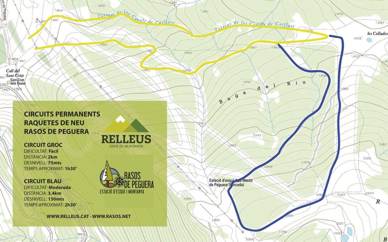
Yellow trail
The yellow trail is suitable for everybody; it’s the shortest and the easiest one.
With a length of 2 km, it is a circular route.
It will approximately take 1 hour and 30 minutes.
Positive altitude change: 75 metres.
Its highest point is Les Collades, spot height: 1.972 metres.
Blue trail
The blue trail includes the yellow trail. Low level of difficulty.
With a length of 3.4 km, it is a circular route.
It will approximately take 2 hours and 30 minutes.
Positive altitude change: 150 metres.
Its highest point is at the end of Les Soques drag lift, spot height: 2.050 metres.
Summer activities
A wide range of experiences awaits you, explore every corner of Rasos de Peguera!
Hiking, trail running, orienteering, MTB, road biking, paragliding or looking for mushrooms.
An exceptional environment close to home.
